Climate Change
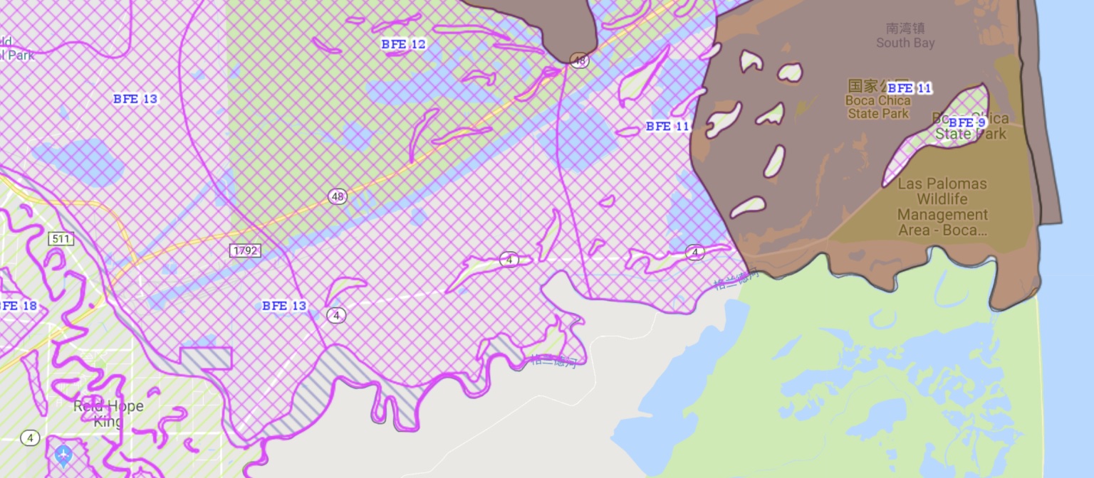
Geographically, the entire battlefield site is within the 100-year floodplain zone.
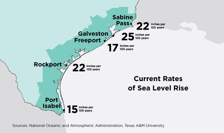
The site is also near the Texas coast facing the Gulf of Mexico. Sea level rise has been the highest in the United States along the Gulf of Mexico and the East Coast. Scientists attribute this to changes in the path and strength of ocean currents. Galveston, Texas has recorded the highest rise over the last 50 years at 12.5 inches, well above the national average of 8 inches (Union of Concerned Scientists, 2014). In the area of the battlefield, sea level rise is predicted to be 15 inches per 100 years. Sea level rise is worsened by local shoreline erosion and land subsidence, which is caused by groundwater withdrawal and the production/extraction of oil and gas. Rising sea levels could initially cause tidal flats and seagrass meadows to decrease in response to increasing water depth. Under certain conditions these flats could slowly advance toward newly inundated land, a phenomenon that has already been observed in the Texas Coastal Bend area (Leslie, 2016).
Additionally, as rare weather events become a new normal with increasing frequency, the site’s geographic and topographic conditions make it more vulnerable to the impacts of catastrophic flooding such as occurred from Hurricane Harvey that hit southeastern inland areas and the middle Texas coastline from mid-August to early September of 2017. According to a study published in the Proceedings of the National Academy of Sciences (2017), extreme weather events with 20 inches or more of rainfall could become far more common over southeastern parts of Texas in the decades to come. The research also warns that the chances of hurricane flooding similar to Harvey will increase six-fold in the next 25 years in Texas and risks will again triple by the turn of the century due to climate change. In times of flood, such as the one that inundated nearby wildlife refuges for several months in 2010, the presence of a border wall amplifies flood impacts as it will prevent wildlife from escaping the river area.
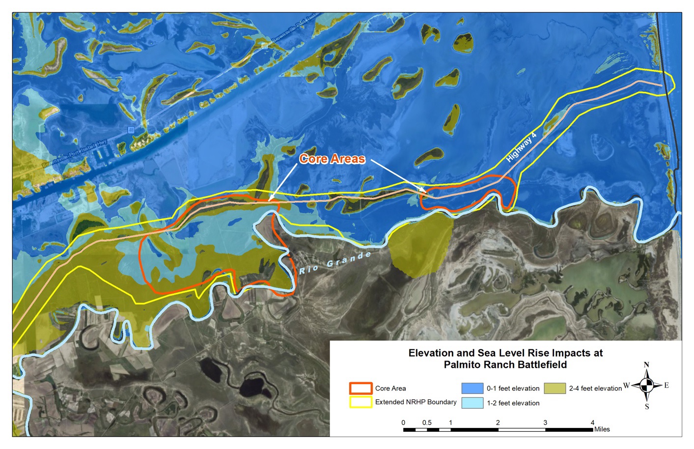
Flooding issues resulting from heavy rainfall, rising sea level, and extreme storm surges pose a threat to the preservation of the battlefield as most of the historic features such as cannons, stone, and interpretation signages are situated in lower elevations of the Rio Grande Valley. The extreme storms may cause soil erosion which may damage any potential artifacts. Similarly, droughts in Texas are expected to become longer and more severe which could damage the battlefield site’s environmental balance and lead to changes in the landscape’s appearance and integrity.